


Couch Voting District, Oregon County, Missouri
About
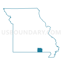
Outline

Summary
| Unique Area Identifier | 609267 |
| Name | Couch Voting District |
| County | Oregon County |
| State | Missouri |
| Area (square miles) | 45.63 |
| Land Area (square miles) | 45.60 |
| Water Area (square miles) | 0.03 |
| % of Land Area | 99.94 |
| % of Water Area | 0.06 |
| Latitude of the Internal Point | 36.58310810 |
| Longtitude of the Internal Point | -91.38104800 |
Maps


Graphs
Select a template below for downloading or customizing gragh for Couch Voting District, Oregon County, Missouri


Neighbors
Neighoring Voting District (by Name) Neighboring Voting District on the Map
- Jeff Voting District, Oregon County, MO
- Jobe & Billmore Voting District, Oregon County, MO
- Johnson & Ozark Voting District, Oregon County, MO
- Myrtle Voting District, Oregon County, MO
- Piney No. 1 Voting District, Oregon County, MO
- Piney No. 2 Voting District, Oregon County, MO
- Thayer No. 1 Voting District, Oregon County, MO
Top 10 Neighboring County Subdivision (by Population) Neighboring County Subdivision on the Map
- Thayer township, Oregon County, MO (3,975)
- Piney township, Oregon County, MO (2,505)
- Couch township, Oregon County, MO (426)
- Myrtle township, Oregon County, MO (388)
- Jeff township, Oregon County, MO (346)
- Johnson township, Oregon County, MO (329)
- Jobe township, Oregon County, MO (106)
Top 10 Neighboring Unified School District (by Population) Neighboring Unified School District on the Map
- Alton R-IV School District, MO (4,750)
- Thayer R-II School District, MO (3,859)
- Couch R-I School District, MO (1,228)